“No offense, honestly this tends to come across as voodoo. I appreciate you as an engineer, and I’m an engineer, and I get it. You can justify a mousing holding an elephant off a cliff.”
– Frank Salkind, Cos CobPumping, Dredging, Water Storage, Diversion Culverts
Mr. Michel said pumping was not a realistic approach with this magnitude of stormwater management.
“A typical fire truck has the capacity to pump water at about 3 or 4 cubic feet per second. That would mean we’d need about 200 fire trucks pumping water during a storm to keep up with this type of flood,” Mr. Michel said.
As for dredging, which has been suggested for Mill Pond, he said it would not benefit the neighborhood to the north.
As for berms, levees or flood walls, Mr. Michel said meeting the Army Corps of Engineers standard requirement of 25 feet clearance beyond the structure would mean taking private property.
As for storage, there was discussion about finding places to store water to be released at a slow rate over a period of time after a storm, including Bible Street Park where there used to be a pond but today is a sports field.
Mr. Michel said that at a public meeting back in 2018 the community had pushed back on the idea of losing the sports field in favor of a retention pond.
Besides, he said, that area is getting to the point where it is impacted by sea level rise and coastal flooding impacts. He said the town had ended review of that idea.
Mr. Michel cautioned against the idea of creating potential pond storage up in the area of Pomerance and Tuchman Parks where there is an existing pond.
“That’s going to take several thousand trees away because we’d have to dig that entire area out,” he said.
As for diverting water through large underground 10 ft wide by 8 ft high “diversion culverts” for a 25-year storm, the town had explored three different locations and all had concerns that during tidal events the pipes would be full of water and not provide the needed capacity. It’s also not feasible given there are many obstacles underground.
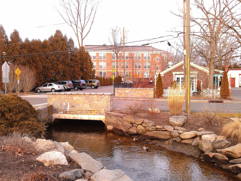
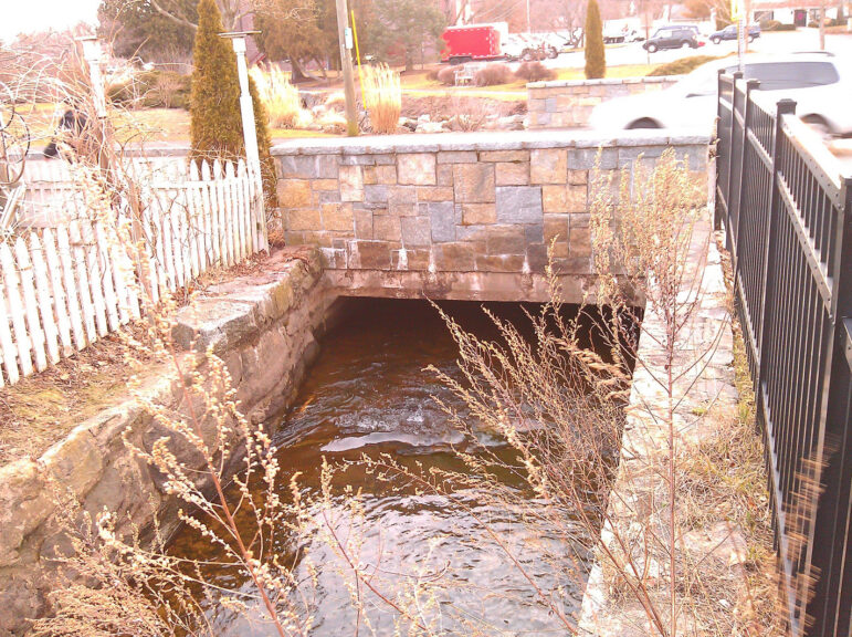
The town also considered widening the Strickland Brook channel, but there isn’t a lot of room without taking private property.
Non Structural Floodproofing
Mr. Michel reviewed non structural approaches residents should consider for their private properties to mitigate flooding.
He shared a map of specific properties recommended for wet flood proofing and dry flood proofing (above) including building ring walls, removable gates for front doors, elevating homes or raising mechanicals to second stories.
He noted FEMA considers anything below a building’s first floor as something to anticipate will be flooded.
Fred Salkind from Grove Street (behind Bible Street Park) expressed frustration.
“I cannot believe the town is not protecting the people who pay taxes and live here. You’re just saying what we have to do. I’m more interested in what you can do,” Mr. Salkind said.
Mr. Salkind said he’d spoken to longtime residents who said Pomerance Park Pond and Mill Pond were both previously 5-6 feet deep.
“No offense, honestly this tends to come across as voodoo,” Salkind said. “I appreciate you as an engineer, and I’m an engineer, and I get it. You can justify a mousing holding an elephant off a cliff.”
“What’s the cost of doing nothing?” asked Adam from Suburban Ave.
Jimmy Santaguida urged the town to consider using the Pomerance property for water storage ponds to help residents in the area.
Ernst Schirmer said he was impressed by the improvements to the newly raised bridge on Sound Beach Ave at Old Greenwich’s Binney Park which were funded by a state grant.
He wondered why similar improvements to flow achieved by that project couldn’t be replicated in Cos Cob.
Jonathan Schmitz who owns property on Suburban Ave, said construction of the bridge on Suburban Ave had unfortunately reduced the hydraulics of the area.
He noted the stream takes a sharp turn around Cos Cob School and the bridge was a barrier.
“The stream has been tortured,” Mr. Schmitz said.
Mr. Schmitz asked Mr. Michel to compare the Suburban Ave bridge to the new Binney Park Bridge.
“That is gigantic, but this (bridge) needs to be changed or taken out,” Schmitz said. “It’s all a matter of mitigation.”
Mr. Michel said the town had analyzed the Suburban Ave bridge.
“It’s one of the things – that it would assist a small stretch, but by the time you get further upstream it doesn’t have any impact,” Mr. Michel said.
Arn Welles suggested diverting water from the area of Mianus Park to move water into the Mianus River. He also suggested dredging Cos Cob Pond and adding flood gates so the pond could be emptied prior to a storm to create storage capacity.
“The sheer volume of water we have coming in is significant. Environmentally that would be a very challenging improvement to do,” Mr. Michel said.
“So let’s do it, if it’s challenging!” someone shouted.
Mr. Schirmer urged action. “We cannot delay until the next generation. Let’s just talk about the money. DPW, you do amazing things, but the last two years, how much money did you actually invest in improvements in storm water management and how much do you have for the next year?” he asked.
“We have invested a decent amount of money in storm water management,” Mr. Michel replied.
“In dollars please?” Schirmer asked.
“It varies from year to year,” Mr.Michel replied. “We probably have about $4 million in ARPA funds for storm water projects. Each year we have about $750,000 we put in for maintaining infrastructure. I’d have to take a look at the budget.”
Peter Quigley said CDM had done a thorough study for the town in 2011-2012 and suggested a plan to put in a storm drainage system to manage storm water with a price tag of $300 million.
“Storm drains are separate than your sewer system. They run parallel. If you don’t have storm drains, guess what happens to the sewer system? It overflows and takes the water,” Quigley said.
Mr. Michel said some of the recommendations in that study were on private property and many were recommendations for surface drainage – keeping water off of the street.
“It’s called funding!” Quigley said emphatically, adding that if the town had set aside the same amount of money it does for sewer maintenance – $15 to $20 million annually – the town would be in a much better position.
Mr. Michel said his department puts in budget requests every year to fund these type of projects.
“We understand there is only so much funding to go around,” he said.
Adam Nalewajek from Suburban Ave, whose property is in the vortex of both riverine and coastal flooding, said there were numerous interests at play. He warned that if nothing was done he was concerned about emergency service access to Cos Cob School.
“What’s the long term impact of doing nothing despite having a really big problem?” Nalewajek asked.
Mr. Michel said DPW had studied the impact to Bible Street should it become impossible to get emergency vehicles through that area.
“We have struggled and have not come up with a solution,” he said. “There really isn’t a good methodology we’re aware of.”
“We should look at this in a unified way,” Nalewajek said. “Ultimately the funding would exist somewhere. I would never want to tell anybody to mandate flood insurance or change flood maps, but ultimately enough voices will rise to the level required, and I think Cos Cob is important to warrant that.”
Myra Klockenbrink said the state legislature had discussed adopting the concept of a storm water authority piloted successfully in New London, where there is a fee imposed, much like a utility, based on the amount of impervious surface on a property.
She said New London had raised enough through the program to substantially meet its infrastructure, maintenance and capital costs for drainage.
Chris von Keyserling said, “It seems to me that if the town can’t create flood control, which is one of its responsibilities over the years, there should be some way of subsidizing the homeowner for upgrades because this is an area problem, not an individual problem.”
“If you keep it out of my basement, it’s got to go somewhere else,” he said.
Click here for the May 10 Strickland Brook public meeting presentation.
See also:
DPW drainage meeting addresses challenges for residents “at the bottom of the bathtub” Jan 22, 2023
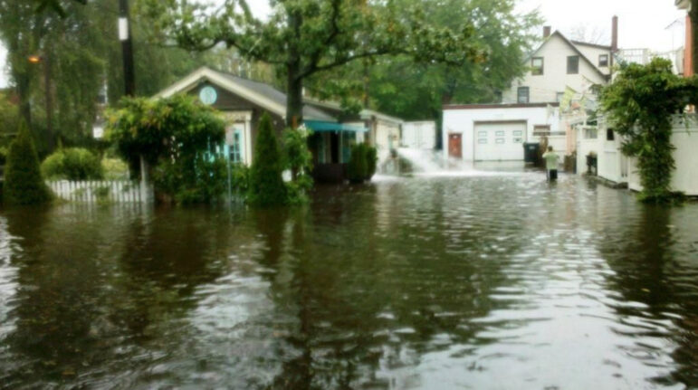
PHOTOS, VIDEO: Friday Flooding in Cos Cob Was Precursor to Severe Cold and Wind Dec 23, 2022
Pemberwick Residents Advised by DPW to Share Responsibility for Flood Risk Reduction Nov 15, 2022
Pemberwick Cleans Up Post-Ida Flooding: “Now We’re a Retention Pond” Sept 5, 2021