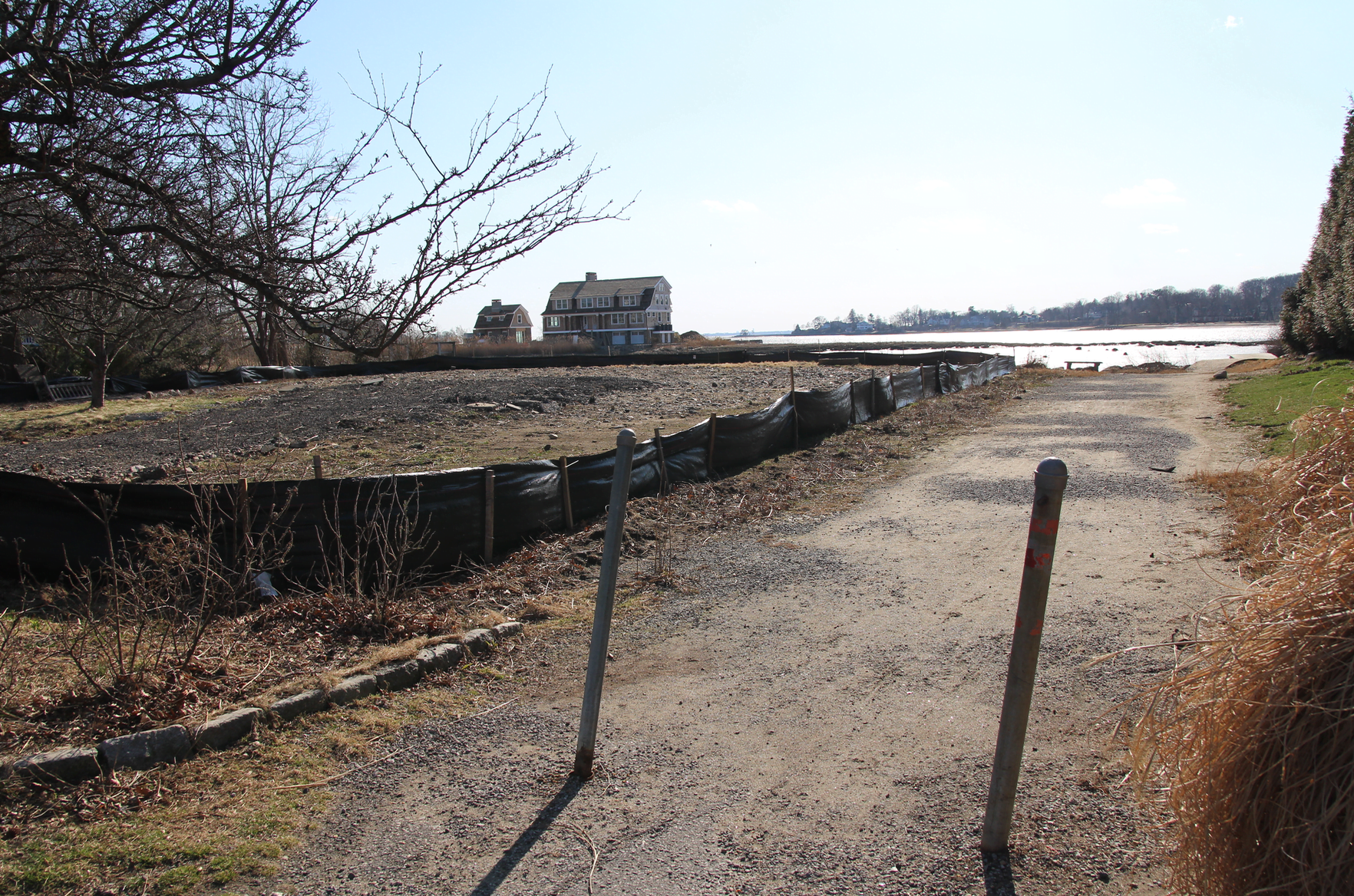
At Tuesday night’s Planning & Zoning meeting dozens of Old Greenwich residents wearing “Shore Acres” stickers opposed an application from Nicole and David Areson for a final coastal site plan to construct a new, 4,500 sq ft house and driveway at 17 Bryon Road. A house dating back to 1934 has already been demolished from the property.
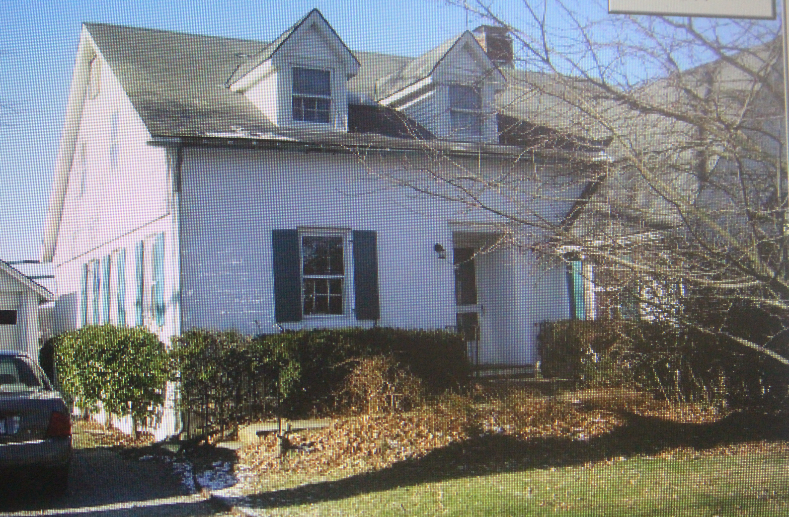
House at 17 Bryon Rd, now demolished. Photo: Assessor’s office at Greenwich Town Hall
The house at 17 Bryon Road has been demolished to make way for new house. Photo: Leslie Yager
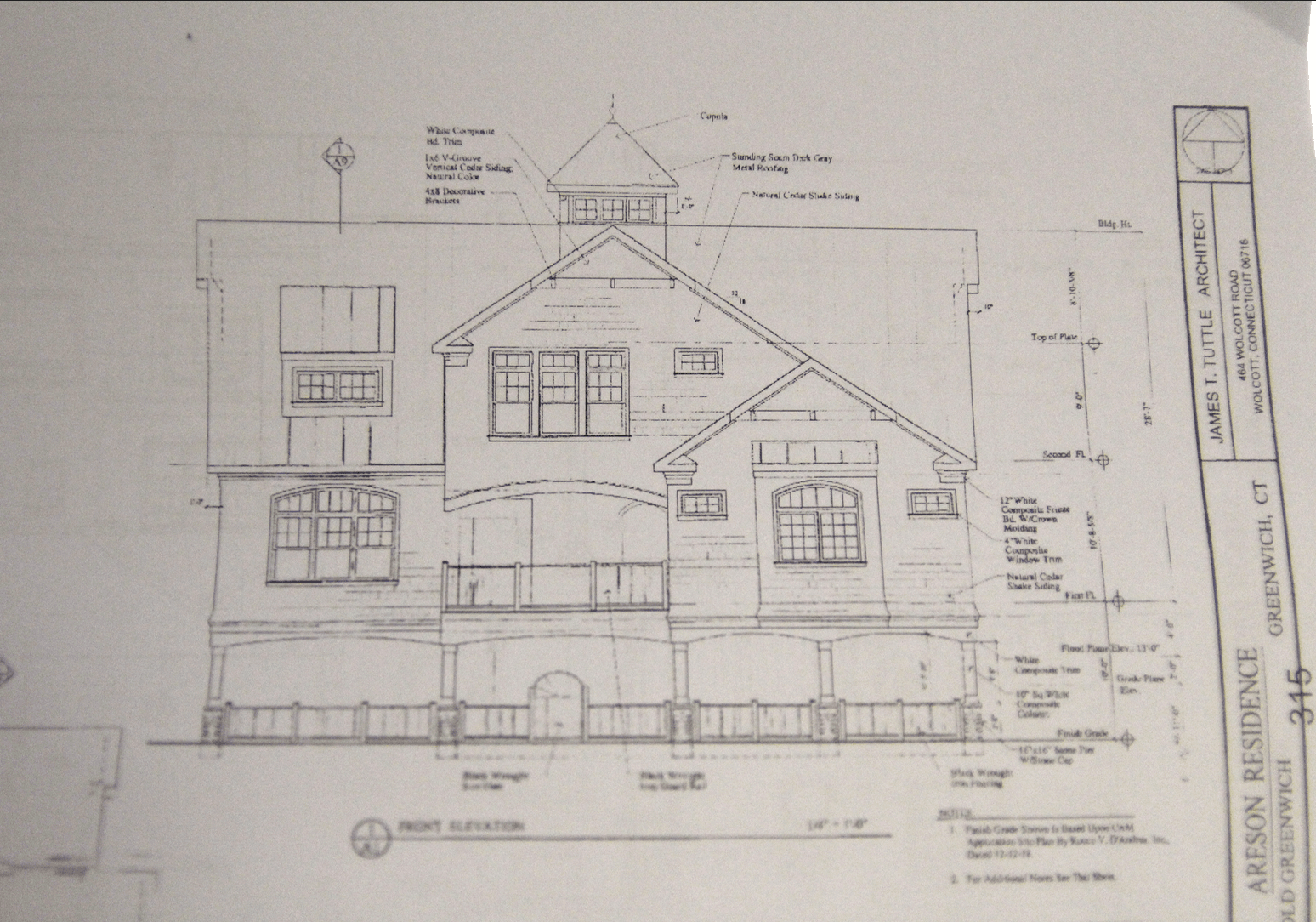
Proposed home, approximately 4,500 sq ft will be in the AE (13′) flood hazard zone. the ground floor will not contain any habitable space and will be open or contain flood vents.
The Aresons bought the property for $1,855,000 from Trevor and Francine Nightingale on Aug 24, 2017.
The neighbors say the applicants are not entitled to expand their FAR based on their parcel with deeded access way to Greenwich Cove for their new house.
The Aresons hold the title to the parcel, but it is encumbered by a water access easement for about 56 neighbors.
The applicants have a 14,000 square foot lot, but if it has a private road through it, they can only use 7,000 for FAR.
Also, the Aresons want to pave a driveway over part of the access way.
While some of the disputes with neighbors are civil matters, and no one denies the Aresons have title to the access way to the water, the main issue for P&Z is whether the access way is actually a road.
![]() Sign up for the free Greenwich Free Press newsletter
Sign up for the free Greenwich Free Press newsletter
The applicants cite a letter sent over 10 years ago from former Greenwich zoning enforcement officer James Maloney saying the access way was not a road.
That letter was used in a P&Z decision to approve an application from a neighboring lot owner at 15 Bryon Rd.
“In a nutshell, if the access way was a road, the new house proposed for lot 28, which is known as 15 Bryon, would have to be set back further,” said the Aresons’ attorney Melissa Klauberg.
“It was determined by the zoning enforcement officer that the access way was not a road, and the commission approved the application without the additional setback,” said Klauberg, who worked with Mr. Maloney at the time, adding that no one appealed the decision.
“We are not an arbiter of what is in a deed and what isn’t,” said P&Z chair Margarita Alban. “We’re about the zoning regulations. But we have the responsibility of figuring out if something is a road or not.”
Klauberg said her clients purchased property from the Nightingales two years ago and acknowledge that a number of neighbors have easement rights across the property for access to Greenwich Cove.
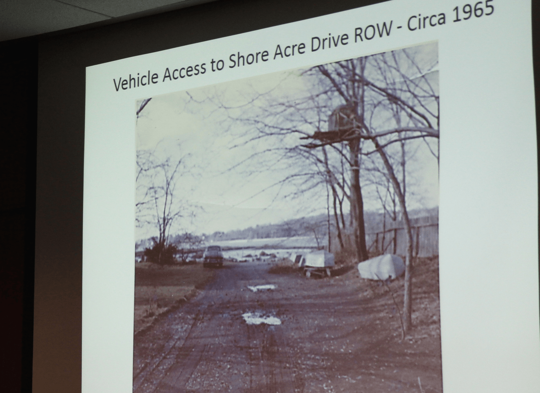
Slide showing the access way to Greenwich Cove around 1965. The photo shows boats, a treehouse, tire tracks and a car.
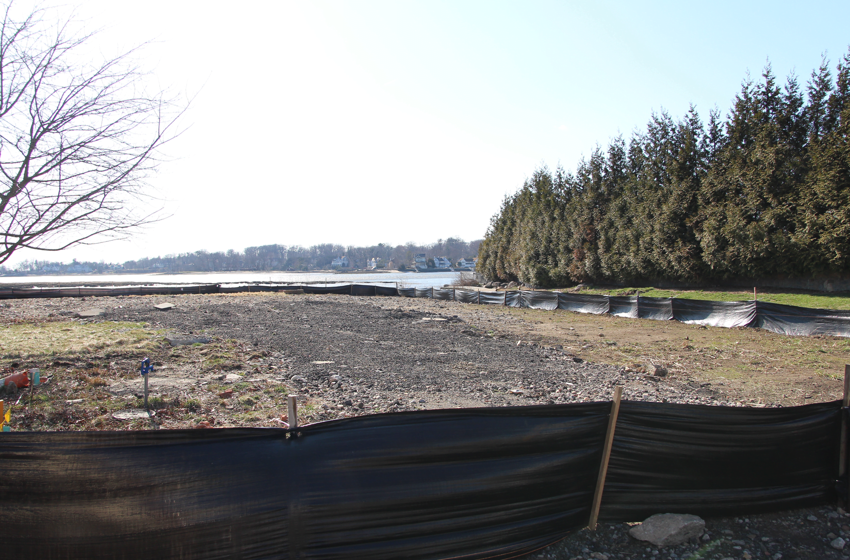
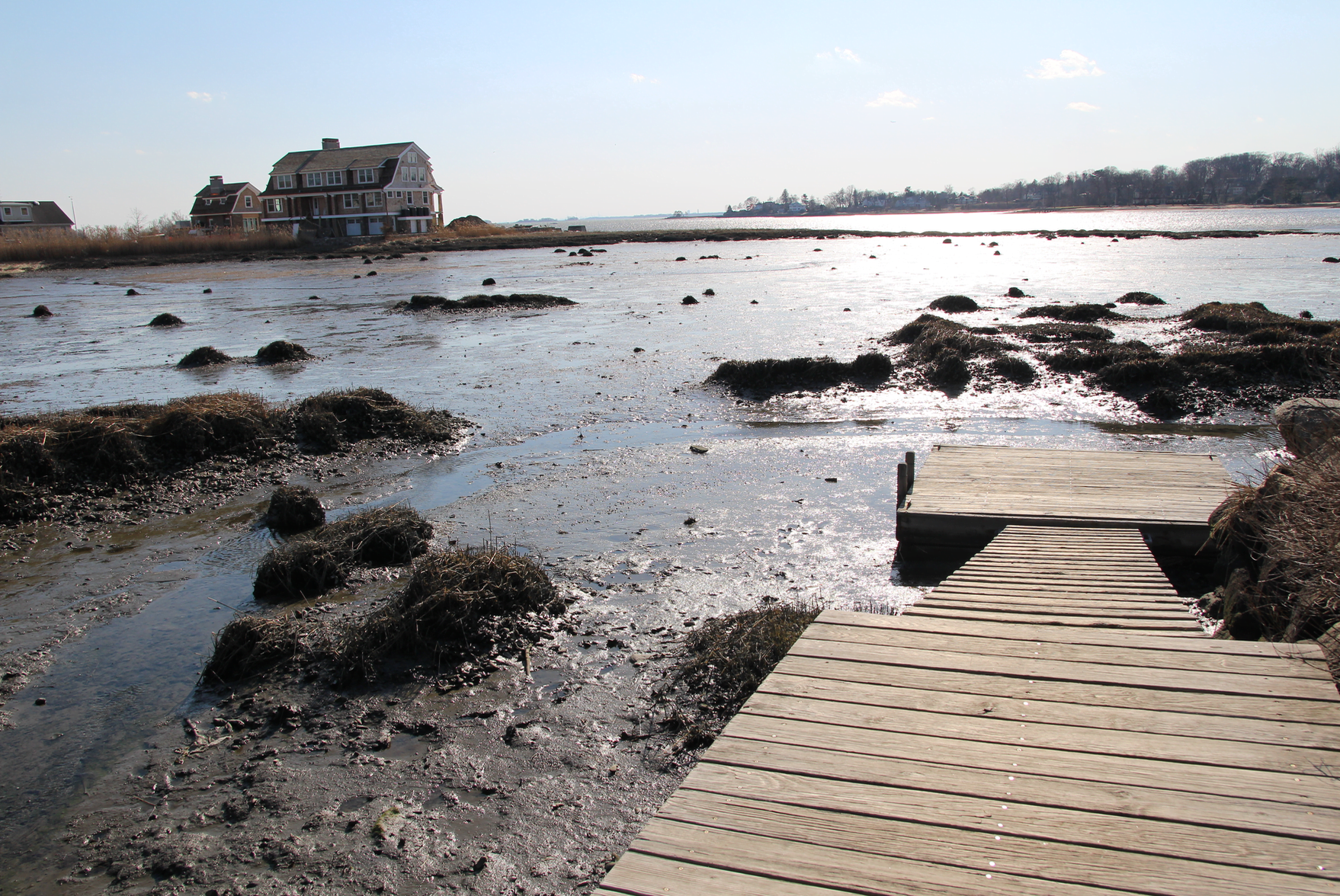
Access way today. April 3, 2019 Photo: Leslie Yager
Klauberg said though neighbors have rights of access to the water, that does not include rights to a dock, which she said has been deemed illegal by the DEEP. She said the dock is the Aresons’ responsibility and that if a child were injured playing there, it shouldn’t be the responsibility of her clients.
“The neighbors also do not have the right to store their boats, kayaks and other items on the easement area,” Klauberg continued. “They only have the right of access to the water.”
Klauberg said that while the previous owners, the Nightingales, let neighbors leave their personal items on their property, that was out of “neighborly kindness.”
“The right of access to the water does not give someone the right to leave their personal items on the easement area or to congregate on the easement, and certainly no right to have a neighborhood party on the easement,” Klauberg said.
Furthermore, she said the easement is for water access and does not include a view of the water.
“The easement does not give you the right to play games of I Spy or practice yoga on the dock. …The fact that the Nightingales permitted their property to be a gathering place does not mean they were legally required to do so.” – Melissa Klauberg, attorney for applicants
She said the Aresons offered to improve the access way, possibly with paving, to add landscaping, and offered to repair and replace the dock to bring it in compliance with the DEEP requirements, but, she said, the neighbors rejected the offer.
“The Aresons have been harassed, and their proposal to make the access way more attractive, accessible and safe has been out and out rejected,” she said.
Neighbors insist the information presented to ZEO Maloney 10 years ago was not accurate. They presented research to the commission going back to 1922 when the subdivision was first created to argue the access way is indeed a road.
Klauberg said there is misinformation in the neighborhood about the Aresons’ intentions. She said her clients recognize and acknowledge the neighbors’ easement rights for access to the water, but debate the extent of the assess rights. However she said, that was a civil matter, not a zoning matter.
After Tony D’Andrea presented a proposal for drainage, Ms. Alban said DPW had an issue with the driveway location and said it was “not acceptable.” D’Andrea said even if there is a driveway there, it would remain wide open. “The only traffic coming out of this is a single car,” he said, adding that he would work it out with DPW.
Conservation comments from Aleksandra Moch included concern about access to the dock and taking care not to damage adjacent Oak trees. D’Andrea disagreed with Ms. Moch’s suggestion that the access path be reduced to “a 5 foot wide cart path,” and said that the proposed 14 ft wide driveway width is within Town regulations.
“It’s for this commission to decide, not the former ZEO in a letter confirming attorney Klauberg’s statements, which were not completely factual.” – Chip Haslun, attorney for the Shore Acres neighbors
Attorney for the neighbors Chip Haslun said two years ago he wrote a letter to Tom Ward, attorney for the prior owners, indicating the stub was actually a road as laid out in the original 1922 subdivision, and that the Aresons were aware of the historic use of the access way.
Haslun also pointed out the road has never been taxed at all by the Town of Greenwich.
“I think that is in recognition that it is a road and not part of a developable piece of land,” he said.
Haslun said former ZEO Maloney was relying on attorney Klauberg’s representations to him, quoting her as saying at the time, “a neighbor” may have had rights over the easement area and the Nightingales had given permission to others to use the property, with no mention at all the dozens of other Shore Acres neighbors with deeded access dating back to the 1922 subdivision.
Dave Hawkins, a longtime Shore Acres neighbor presented his research on deeds in the neighborhood, saying they specified water access. Photo: Leslie Yager
Shore Acre Drive neighbor Dave Hawkins said Ms. Klauberg misrepresented the facts to ZEO Maloney, including that the lot was a vacant, undeveloped and inaccessible to motor vehicles.
“It’s clearly not a vacant lot. It’s a right of way and an extension of the paved part of Shore Acre Drive and contains an improved gravel road bed that is used by motor vehicles,” he said. adding that there are removable bollards at the opening of the driveway. He shared a 1925 sales brochure created by the developer advertising all the lots as “waterfront” because there is a strip along the water included in the easement.
“This was a waterfront development. It was called Shore Acres for a reason,” he said. In 1924 the developer transferred some of the roads in the development to the Town, but the Town declined to take over the stub. “You can’t just do away with a road designated on a recorded map. And you can’t do away with it based on a ZEO letter based on inaccuracies.”
Hawkins said the first non waterfront deed was written in 1923 and stated, “It’s together with an easement right and privilege, in, over and upon the streets, roads, beach, waters of Greenwich Cove and plots for the benefit for lot owners.”
Hawkins said by 1932 Ben Lockwood had sold 56 lots and all the language in the deeds reflected the water access. He said nowhere do any deeds refer to vacant land, but rather to “Shore Acre Drive.”
He said Town Grand Lists have consistently identified Shore Acre Drive as extending to Greenwich Cove, albeit a private portion of the road.
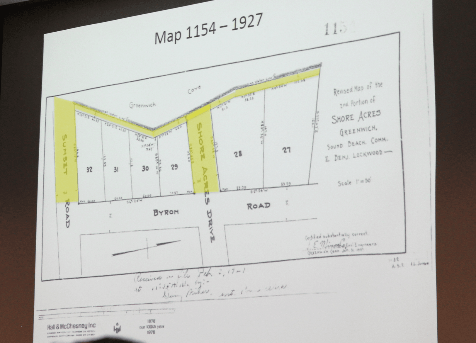
Map from 1927. Yellow reflects the easements via the stubs and along the shore of Greenwich Cove in the original subdivision.
“We’re not making this stuff up,” Hawkins said emphatically. He said a survey from Mr. D’Andrea’s firm in 2007 was not labeled vacant lot. “It’s labeled Shore Acre Drive. That recognition has disappeared entirely. But that’s a matter of wishful thinking, not reality.”
“The neighborhood has enjoyed for almost 100 years the use of the entire length of Shore Acre Drive to access the waters,” he said.
P&Z director Katie DeLuca asked what the Aresons’ deed states for the stub.
“Their deed states they were conveyed the grantor’s interest in that portion of Shore Acre Drive that lies westerly of Shore Acre Drive,” Hawkins said. “It says the parcel in question is referred to as ‘that portion of Shore Acre Drive.'”
Hawkins said the Aresons have “a heavily encumbered title to a road.”
The neighborhood has no formal community association, but over the years Hawkins said neighbors have gotten together to do clean ups and dock repairs.
“It’s a very neighborly operation and it has worked. This lot was the home of one family from 1949 to 2017 and everything worked well,” Hawkins said.
“It’s gotten complicated and I think you should do something to rectify it,” commissioner Peter Levy said.
Paul Pugliese, a resident of Shore Acres since 1992, said residents pay higher tax assessments because of their water rights, proximity to water and views of water. “It’s a significant amount,” he said.
Mr. Pugliese said Ben Lockwood conveyed all the other roads in the original subdivision to the Town, except for the Shore Acre Drive stub and Sunset Road stub, which remained private roads that were not deeded to the Town.
“Had the original developer decided it was a path to the water and not a road, it could have been 10 ft wide – it would have been a path to the water and he would have had a larger, more valuable lot.”
Pugliese said Ben Lockwood was ahead of his time, creating these access strips to the Cove for the benefit of the entire subdivision. He said Lockwood also created a 10 ft strip along the water connecting the two stubs and connecting them to the adjacent neighborhood.
Pugliese said if P&Z determine the stub to be a road, the applicants have to observe side yard setbacks, which in this case wold be 14 ft because it’s an undersized R12 lot.
He said placing the driveway on top the right of way is problematic. The DPW recommended a driveway not align with the intersection.
“It’s also in the jurisdiction of the DEEP,” he continued. “And, there is a reasonable alternative, which is to have the driveway on the southern side of the lot and elevate it so it floods less.”
“In addition, kids are always walking up and down that path and riding bikes and walking, and having a driveway there is a safety issue. Backing out of the driveway would be a serious problem.” – Paul Pugliese
Also, Pugliese argued that if the applicant is allowed to put their driveway partly on the right of way, they would likely park cars in it, obstructing views and access to the water.
Mark Strauss, a neighbor from nearby North Street, said he grew up in the neighborhood and, counter to what Ms. Klauberg said, he argued that to his knowledge there was “never a mess of boats” and “never has there been parties or a big gathering” on the access way since the 1980s.
He said the neighbors’ deeds vary but all specify water access.
 In Klauberg’s closing remarks she said her clients own the dock, but that it has been deemed illegal by DEEP. She said the neighbors will no longer have access to it.
Klauberg said the access way has never been taxed but the Aresons went to the Assessor’s office to add themselves to the tax rolls.
“They went to the Assessor to correct the field card and were told that could not be done until a map was filed.” She said her clients filed a map, showing that the they own all that land, and showing it had an easement.
“The assessor said, ‘Oh great, now we can tax it,'” Klauberg said.
 “The town will tax the highest use,” DeLuca said. “If the assessor sees five kitchens, she will tax it, regardless of whether there are zoning violations.”
“We’re just correcting the records,” Klauberg said. “They have rights to walk all over the 50 feet. The easement is for access to the water. It’s not a playground.”
If the commission finds the stub is a private road, the applicant will not be able to use it toward their FAR calculation.
At the end of the discussion, the application was left open and the P&Z commission asked the attorneys for each side to submit a brief summarizing all their key points.