From Greenwich Police 6:00pm, Thursday, Jan 27:
The latest runs of the GFS, EURO, Canadian and NAM computer models have remained basically the same as the last set of models Thursday morning. However, a sharper cutoff of snow on the western edge of the storm is more apparent in the models. A low pressure system is still forecast to form off the North Carolina coast Friday evening. This low is forecast to very rapidly intensify as the storm moves to the northeast. At this time the consensus (aka Average) track of all 4 models brings the center of this major winter storm approximately 70 miles southeast of Cape Cod at approximately 6:00pm Saturday evening.
If the storm follows this track, we can expect a Nor’Easter (with possible blizzard conditions in eastern CT) starting before daybreak on Saturday and continuing until Saturday evening. Northeast winds could gust to 50 – 60 MPH at times along the coast with temperatures in the upper teens and low 20’s. The impact on travel could be major with very low visibilities and snow-covered roads. A minor to moderate number of power outages are possible. Most air travel in the Northeast could be cancelled.
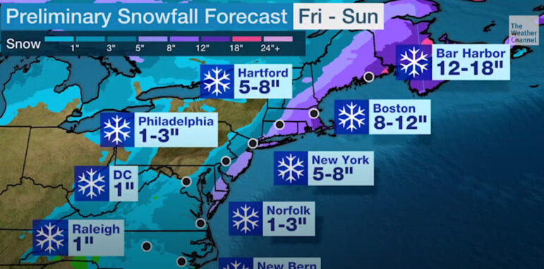
Total snowfall could range from 6” – 12” in Western CT, 12” – 16” in Central CT and 16” – 20” in Eastern CT (especially near the RI border).
Snowfall amounts are very dependent on the exact track. Any slight change in the track of this very powerful storm will have a significant impact on snowfall amounts here in Connecticut.
DESPP/DEMHS will continue to closely monitor this major winter storm.
Police say the next update will be sent out at 9:00 am Friday morning.
Original story: The National Weather Service is forecasting heavy snowfall and high winds for Greenwich, and a winter storm watch has been issued for Friday night through Saturday.
The snow is expected to begin late Friday. Saturday will be the highest impact day, with heavy snow and strong winds expected from eastern Long Island to coastal New England.

There is greater than usual forecast uncertainty for the track of this storm.
A pair of storm systems may meet and combine off the Eastern Seaboard into a powerful low pressure system. Heavy snow, gusty winds and coastal hazards are possible from North Carolina to New England with the most significant impacts in eastern New England. This forecast will continue to evolve.
Greenwich Police announced their Emergency Operation Center will be activated virtually.
The public safety complex lobby will be open as a warming center.