On Sept 13, Greenwich experienced flooding, when heavy rain caused flash flooding, closing roads and stranding vehicles.
Again, the National Weather Service has issued a Coastal Flood Warning for Greenwich, in effect from Friday, Sept 25 at 6:00pm until Sunday, Sept 27 at 6:00pm.
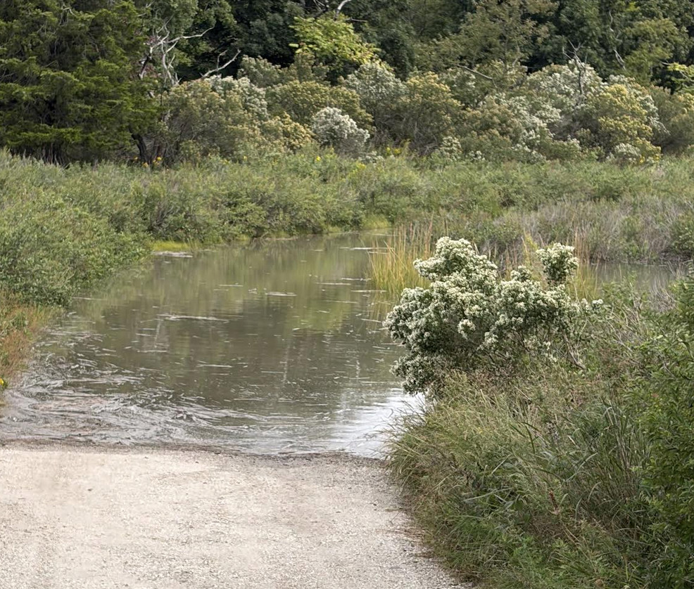
Tod’s Point. Sept 25, 2026 Contributed photo
* WHAT...Two to three feet of inundation above ground level
  expected in vulnerable areas near the waterfront and shoreline.

* WHERE...In Connecticut, Southern Fairfield County. In New
  York, Southern Westchester, Bronx and Northern Queens Counties.
* IMPACTS...Widespread flooding of vulnerable areas near the
  waterfront and shoreline, including roads, parking lots, parks,
  lawns, and homes and businesses with basements near the
  waterfront. Numerous road closures are likely, and vehicles
  parked in vulnerable areas near the waterfront will likely
  become flooded. Flooding will also extend inland from the
  waterfront along tidal rivers and bays.

* ADDITIONAL DETAILS...Moderate flooding will occur over multiple
  high tide cycles tonight through Sunday. The worst flooding is
  expected with the daytime high tide cycles Saturday and Sunday.
Precautionary & Safety Actions
Protect Property: Take necessary steps now to secure flood-prone property and basements.
Never Drive Through Floodwaters: If you must travel, do not drive around barricades or through flooded roads of unknown depth. Turn around, don’t drown.
Stay tuned to local news forecasts, emergency management updates and official NWS alerts for changes to the forecast. In case of an emergency, call 911.
Move Vehicles: Move vehicles out of low-lying and flood-prone waterfront areas before this evening.
Wind Advisory
There is also a Wind Advisory that includes Greenwich beginning Friday at 2:00pm until Sunday at 6:00am.
* WHAT...North winds 20 to 25 mph with gusts up to 55 mph
  expected.

* WHERE...Portions of southern Connecticut and southeast New
  York.

* WHEN...From 2 PM Friday to 6 AM EDT Sunday.

* IMPACTS...Gusty winds will blow around unsecured objects. Tree
  limbs could be blown down and a few power outages may result.

PRECAUTIONARY/PREPAREDNESS ACTIONS...

Winds this strong can make driving difficult, especially for high
profile vehicles. Use extra caution.

Secure outdoor objects.
There is also a Gale Warning for Long Island Sound
Gale Warning
URGENT - MARINE WEATHER MESSAGE
National Weather Service New York NY
605 AM EDT Fri Sep 25 2026

* WHAT...Northeast winds 25 to 35 kt with gusts up to 45 kt and
  seas 4 to 7 feet.

* WHERE...Long Island Sound west of Port Jefferson and New Haven.

* WHEN...Until 6 AM EDT Sunday.

* IMPACTS...Strong winds will cause hazardous seas which could
  capsize or damage vessels and reduce visibility.

PRECAUTIONARY/PREPAREDNESS ACTIONS...

Mariners should alter plans to avoid these hazardous conditions.
Remain in port, seek safe harbor, alter course, and/or secure the
vessel for hazardous conditions.
• The Greenwich High School football home game vs Fairfield Warde will start at 12:00 noon instead of 1:00pm on Saturday, Sept 26.
• The Greenwich Farmers Market for Saturday, Sept 26 has been canceled
• Adopt A Dog Puttin’ on the Dog Canceled for Sept 27
Note: Adopt A Dog has decided to cancel Puttin’ On The Dog, scheduled for Sunday, September 27. With a Nor’easter expected to bring high winds and significant coastal flooding, the safety of our dogs, guests, volunteers, vendors, sponsors, and staff must come first.
Puttin’ On The Dog is Adopt-A-Dog’s largest fundraiser of the year, providing critical support for the food, shelter, medical care, training, and enrichment our dogs need while they wait for loving homes. Although the event cannot go forward, that work continues every day.
Anyone who purchased tickets in advance, Adopt A Dog will send them a charitable contribution receipt for their records. Anyone who had intended to buy tickets at the gate, please consider donating an amount equal to the planned ticket purchase. Your support will help ensure that, even though Puttin’ On The Dog cannot take place this year, the dogs who depend on us will continue to receive the care they need.
Your generosity would help mitigate the significant impact of this cancellation and ensure that the funds from your ticket go directly toward caring for the dogs who depend on us. Adopt A Dog will gladly provide a charitable contribution acknowledgment for your records.
Half Marathon
An important update regarding the Greenwich Half Marathon. After careful consideration & consultation with Town officials, the Greenwich Road Runners have made the difficult decision to postpone Sunday’s race due to the forecast for high winds, potential coastal flooding, power outages, & fallen trees & power lines.
The race has been rescheduled for Sunday, October 18.
The safety of our runners, volunteers, spectators, & the community remains our highest priority. While we are disappointed to postpone the event, we believe this is the right decision given the expected conditions.
All registered participants will automatically be transferred to the new race date. Participants who are unable to attend on October 18 may defer their registration to the 2027 race.
If anyone had planned to run on September 27 but was not previously able to register, we still have spots available for October 18 & would be delighted to welcome additional runners.
https://runsignup.com/Race/