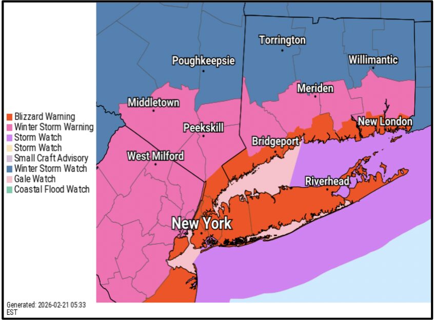
The National Weather Service issued a Blizzard Warning on Feb 21 for Southern Fairfield County that will go into effect from 6:00am on Sunday to 6:00pm on Monday. The forecast is for total snow accumulations between 13 and 18 inches and winds gusting as high as 55 mph.
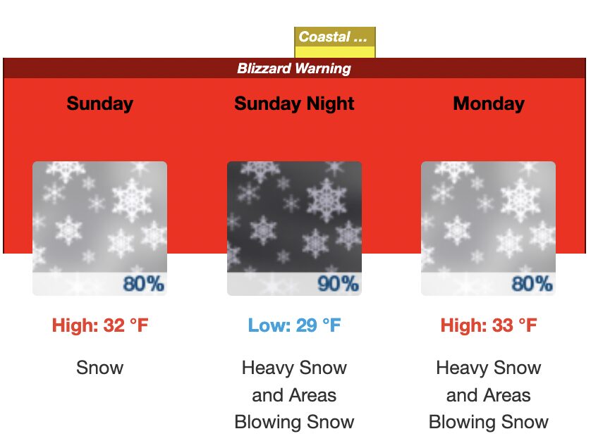
According to the NWS, visibilities may drop below 1/4 mile due to falling and blowing snow. Whiteout conditions are expected and will make travel treacherous and potentially life-threatening. The strong winds and weight of snow on tree limbs may down power lines and could cause sporadic power outages. The hazardous conditions could impact the Monday morning and evening commutes. Strong winds could cause tree damage.
Also, the strongest winds and blizzard conditions are expected to Sunday night into Monday. However, snow will move in during the morning and afternoon hours.
Travel should be restricted to emergencies only. If you must travel, have a winter survival kit with you. If you get stranded, stay with your vehicle. Check local Department of Transportation information services for the latest road conditions. A Blizzard Warning means severe winter weather conditions are expected or occurring. Falling and blowing snow with strong winds are likely. This will lead to whiteout conditions, making travel extremely dangerous. Do not travel. If you must travel, have a winter survival kit with you. If you get stranded, stay in your vehicle.
There is also a coastal flood watch in effect late Sunday night for Southern Fairfield County, Southern New Haven and Southern Westchester.