On Sept 13, Greenwich experienced flooding, when heavy rain caused flash flooding, closing roads and stranding vehicles.
Again, the National Weather Service has issued a Coastal Flood Warning for Greenwich, in effect from Friday, Sept 25 at 6:00pm until Sunday, Sept 27 at 6:00pm.
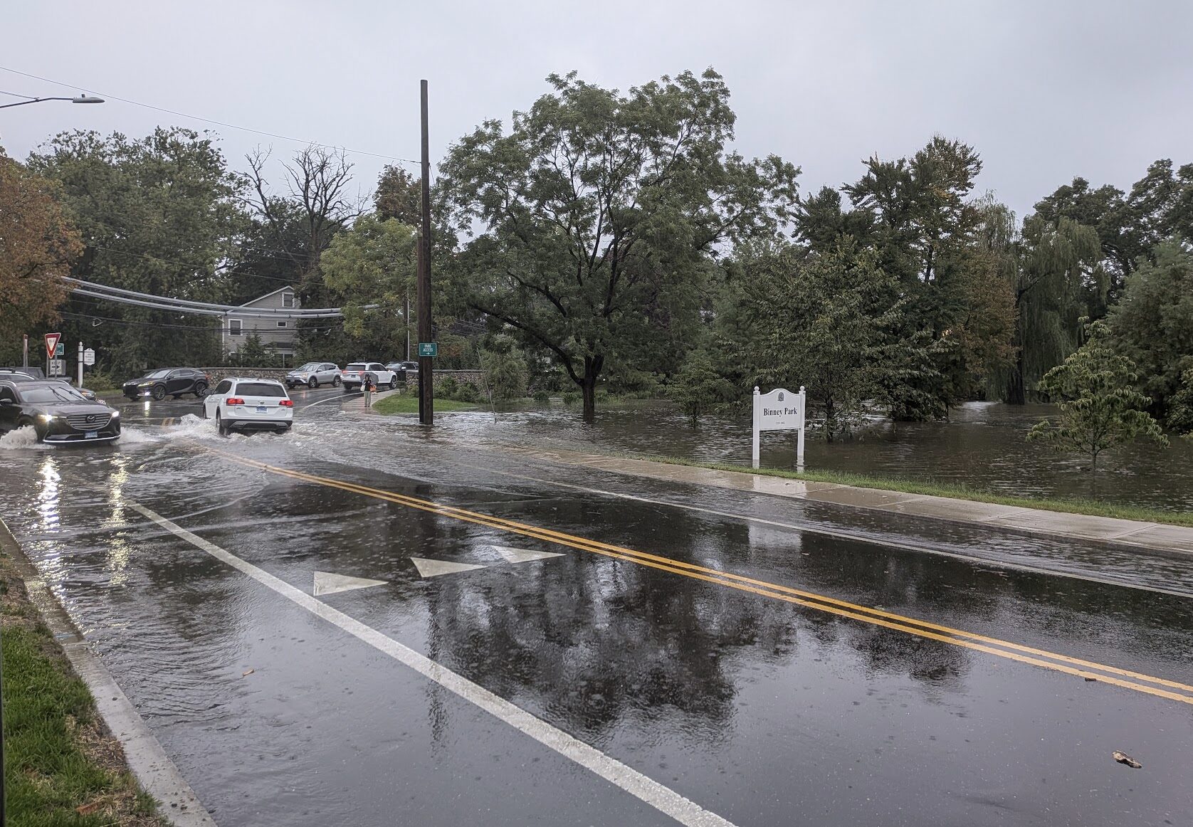
Flooding in Old Greenwich around Binney Park. Sept 13, 2026 Contributed photo.
* WHAT...Two to three feet of inundation above ground level
  expected in vulnerable areas near the waterfront and shoreline.

* WHERE...In Connecticut, Southern Fairfield County. In New
  York, Southern Westchester, Bronx and Northern Queens Counties.
* IMPACTS...Widespread flooding of vulnerable areas near the
  waterfront and shoreline, including roads, parking lots, parks,
  lawns, and homes and businesses with basements near the
  waterfront. Numerous road closures are likely, and vehicles
  parked in vulnerable areas near the waterfront will likely
  become flooded. Flooding will also extend inland from the
  waterfront along tidal rivers and bays.

* ADDITIONAL DETAILS...Moderate flooding will occur over multiple
  high tide cycles tonight through Sunday. The worst flooding is
  expected with the daytime high tide cycles Saturday and Sunday.
Precautionary & Safety Actions
Protect Property: Take necessary steps now to secure flood-prone property and basements.
Never Drive Through Floodwaters: If you must travel, do not drive around barricades or through flooded roads of unknown depth. Turn around, don’t drown.
Stay tuned to local news forecasts, emergency management updates and official NWS alerts for changes to the forecast. In case of an emergency, call 911.
Move Vehicles: Move vehicles out of low-lying and flood-prone waterfront areas before this evening.
Wind Advisory
There is also a Wind Advisory that includes Greenwich beginning Friday at 2:00pm until Sunday at 6:00am.
* WHAT...North winds 20 to 25 mph with gusts up to 55 mph
  expected.

* WHERE...Portions of southern Connecticut and southeast New
  York.

* WHEN...From 2 PM Friday to 6 AM EDT Sunday.

* IMPACTS...Gusty winds will blow around unsecured objects. Tree
  limbs could be blown down and a few power outages may result.

PRECAUTIONARY/PREPAREDNESS ACTIONS...

Winds this strong can make driving difficult, especially for high
profile vehicles. Use extra caution.

Secure outdoor objects.
x
There is also a Gale Warning for Long Island Sound
Gale Warning
URGENT - MARINE WEATHER MESSAGE
National Weather Service New York NY
605 AM EDT Fri Sep 25 2026

* WHAT...Northeast winds 25 to 35 kt with gusts up to 45 kt and
  seas 4 to 7 feet.

* WHERE...Long Island Sound west of Port Jefferson and New Haven.

* WHEN...Until 6 AM EDT Sunday.

* IMPACTS...Strong winds will cause hazardous seas which could
  capsize or damage vessels and reduce visibility.

PRECAUTIONARY/PREPAREDNESS ACTIONS...

Mariners should alter plans to avoid these hazardous conditions.
Remain in port, seek safe harbor, alter course, and/or secure the
vessel for hazardous conditions.